Using satellite radar altimetry (which measures elevation) combined with previous data, researchers at UC San Diego have doubled the resolution of the previous decades-old ocean floor map. Large ocean features create a small "bump" in the sea surface above them; for example, a mile high volcano elevates the ocean surface by 10 centimeters.
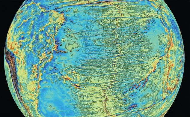
New ocean gravity map. Image: Sandwell et al. (2014)
The new altimetry-based gravity anomaly model can resolve features over one mile in height; anything smaller than that would be missed. While detecting miles-high features might not seem particularly impressive, it provides twice the resolution of previous methods.
Ship-based surveys provide the highest spatial resolution (30 feet) of the sea floor, but move slowly (10 mph) and cost thousands of dollars per hour. Ten ships could map the entire ocean in ten years—but at a price comparable to a Mars mission. In fact, the surface of Mars is mapped to a resolution over 100 times greater than our oceans. A few miles of salty water are much harder to see through than a hundred million miles of empty space!
Newly-discovered features include an extinct spreading center in the Gulf of Mexico, a major propagating rift (related to seafloor spreading) in the South Atlantic Ocean, and 5,000 additional undersea volcanoes (raising the total to 10,000).
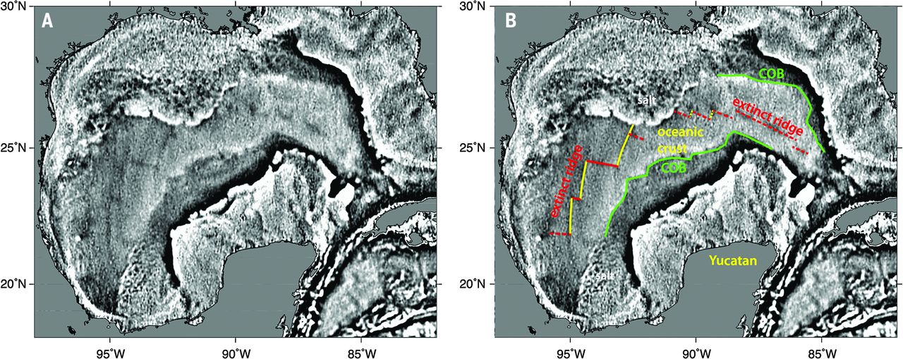
Seafloor spreading center discovered in the Gulf of Mexico. Image: Sandwell et al. (2014)
Watch the video below for more information on how the new method works, as well as some of the revelations it produced.
Sandwell D. T., Müller R. D., Smith W. H., Garcia E, & Francis R. (2014). New global marine gravity model from CryoSat-2 and Jason-1 reveals buried tectonic structure. Science, 346(6205):65-7. doi: 10.1126/science.1258213.